GIS SERVICES
Intelligent business solutions where location matters


GIS SERVICES
Intelligent business solutions where location matters
NeST GIS is a products and services entity under NeST Digital Technologies, offering advanced geospatial solutions with a focus on government, cadastral, utilities, transportation and facilities management.
One of the NeST’s key differentiators in the industry is that it is a software development company that has added GIS as a horizontal technology focus area, rather than a ‘mapping’ company attempting software development in GIS. We help to GIS‐enable the business processes of our clients.
Offerings
GIS Application Development Services
With vast experience, NeST delivers comprehensive end-to-end IT solutions from ideas to maintenance. We follow industry-standard Agile and Waterfall models, successfully implementing custom GIS tools across various domains.
GIS Data Development Services
NeST has a skilled team specialized in data development and analysis using top software platforms like Esri, ArcFM, Autodesk, Bentley, MapInfo, Erdas Imagine (Hexagon), FME, IBM Maximo, and TerraSolid suite. With 17+ years of expertise in mapping and GIS analytics for cadastral & land administration, utilities (electric, water, telecom, gas & sewage), asset management, & transportation.
LiDAR Services
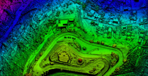
Our expert team excels in 3D & LiDAR data processing (static/mobile/aerial) for Terrain Modeling, Flood Mapping, 3D City Modeling, Airport Obstruction Surveys, Corridor & Right of Way Mapping, Utility Network Design/MRE, Transportation Clearance Analysis, Asset Inventory & Signage, and Forest Mapping.
Consultancy Services
The NeST GIS team comprises expert Domain and Functional Consultants who excel in conceptualizing and architecting GIS solutions, surpassing customers’ needs. Our consultancy services include business process modeling, bid support, system architecture, data modeling, and GIS Cloud Implementation Support.
Related Insights
Connect with our experts in GIS & let’s collaborate together!


