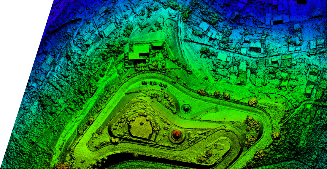
Utility poles and towers are fundamental pieces of infrastructure used for power and telecom utilities across every country worldwide.A US-based utility companyrequired details of utility poles and attachmentsas 3D data from Mobile LiDAR Survey Mapping and Data Extraction Services for performing the operations on their FTTH Project.
Challenge
The client’s objective primarily included updating the database of utility poles by capturing data from the point cloud data using MicroStation tools along with updating attributes in MicroStation. The minimum features to be updated included poles and relevant attachments like wires, anchors, guys, transformers, streetlights, etc., which were used for pole loading analysis operations.
Solution
Mobile LiDAR (ML) data extraction and processing services offered utility pole information to support the design and construction of fiber optic networks and systems.
The client shared the input data as shapefiles and was directed to deliver the final output data after processing them as GDB files. The shapefiles (POD index files and Design poles) and the attributes of the input data were imported to the ArcGIS 10.1 environment. The total poles were subdivided into different users, which effectively helped allot jobs for feature capturing of the utility poles.
Different users were allocated in the attribute table by selecting the respective areas containing poles. The individual user databases were merged into one database to create a seamless network of poles and spans within each fiber hut. The merged geodatabase (MDB) was then converted into the XML file, imported to the file geodatabase (GDB), and delivered to the client.
The project was successfully completed by meeting all the predefined quality requirements. By customizing MicroStation tools, the team could maintain a higher quality of deliverables than expected.
Value Delivered
An improved, positional accurate dataset where users could use spatial data to know where the utilities are located
A fully customizable and accurate GIS feature extraction tool that invalidates operational costs in terms of software licensing
A centralized database architecture using SQL server for simultaneous multi-user editing
A mobile-based (iOS, Android) Utility Pole Feature Tracking application for field-level inspection and attribute updates to the master database for missing details